


GTVe J3

PhilippeC54
User
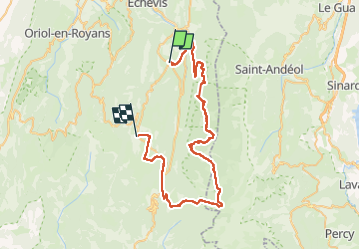

Length
67 km

Max alt
1674 m

Uphill gradient
1964 m
Km-Effort
93 km

Min alt
715 m

Downhill gradient
1792 m
Boucle
No
Creation date :
2022-06-30 06:38:16.003
Updated on :
2022-06-30 15:48:43.07
5h06
Difficulty : Very difficult

FREE GPS app for hiking
 SityTrail
IGN / Geographical institutes
SityTrail Plus
The world is yours!
About
Trail Mountain bike of 67 km to be discovered at Auvergne-Rhône-Alpes, Drôme, La Chapelle-en-Vercors. This trail is proposed by PhilippeC54.
Positioning
Country:
France
Region :
Auvergne-Rhône-Alpes
Department/Province :
Drôme
Municipality :
La Chapelle-en-Vercors
Location:
Unknown
Start:(Dec)
Start:(UTM)
690428 ; 4982205 (31T) N.
Comments